Originally Posted by
franklin_m
Actually, not unusual at all. I've attached two images, one is a standard 3 degree glideslope and the corresponding AGL altitudes by mile. I've also attached an excerpt from an IFR approach showing that at 5.8 miles the aircraft has already descended to 1500 MSL. Since the touchdown point is 44 MSL, I'm guessing he starts the approach at around 1450 AGL about 5 miles or so from the field. So to be at 1200' at 4 or 3 would bevery reasonable.
While I’m sure many know this, for those that don’t, here’s how to calculate aworst case a 3 degree cone around any airport: take the distance from the airport in nautical miles (that's what airplanes use) multiplied 6076 (feet/nm) multiplied by the sine of 3 degrees. Using that calculation, an airplane at 3nm on a perfect three degree glideslope could be as low as 954 feet (note: excel’s sine function requires the angle to be in Radians – in that case, the calculation is (nautical miles x 6076) x sine (3 x 3.14/180). What you'll see is that even as far as five miles away, airplanes on instrument approaches could be as low as 1590 feet AGL, well within capabilities of many quads and RC planes.
Most real world approaches bump up the altitudes up a bit from a perfect 3degrees, but that’s a worst case. Oh, if someone asks why not use tangent of the angle, the reason is that mileage measurement in the airplane on a VOR/DME or TACAN approach is line of sight from the airplane - so sine makes for a more precise calculation.
Honestly, many quite small airports have instrument approaches, which is why I'm personally a fan of limiting RC ops to 400' AGL. I know that's not popular, but from a risk management standpoint, it keeps them away from the overwhelming majority of full scale operations and vastly reduces the risk to the traveling public.


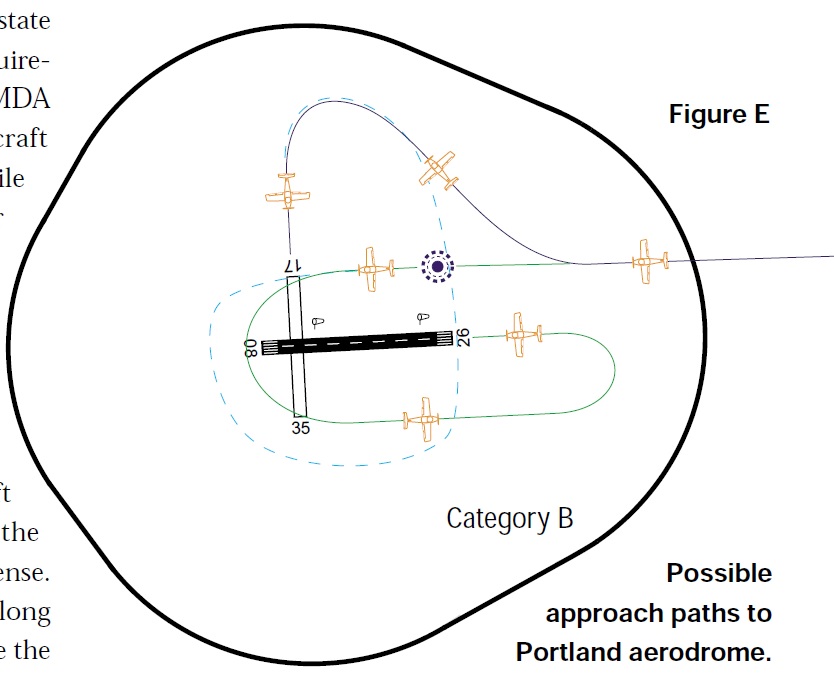
The one thing that gets overlooked in these discussions are the IFR circling areas around airports.
I agree with your numbers for an ILS approach or a visual approach on the PAPI - 3 degrees (IE 300 feet per nautical mile distance from the runway)
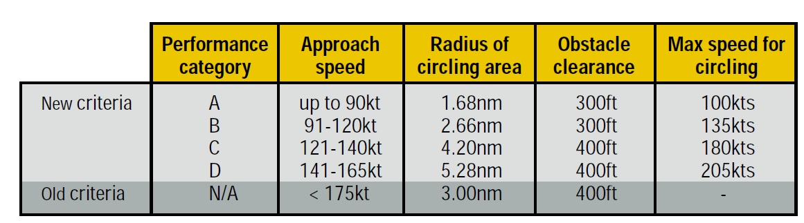
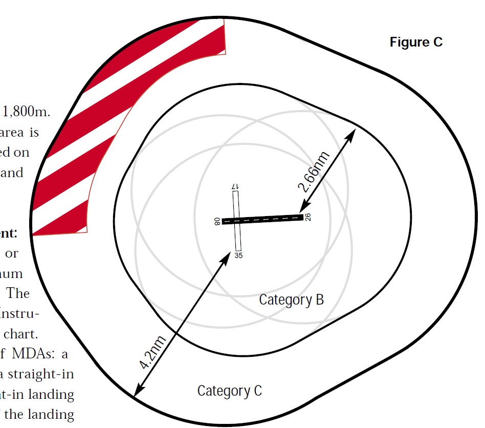
But airports can have a variety of instrument approaches and some of these allow for visual circling - The size of the circling area is based on aircraft performance (landing speeds) in 5 categories.
Look at Category E in the following diagram and see how the 4.5 nautical miles (about 5.2 miles) is calculated.
An aircraft circling in this area after an instrument approach could be at 400 feet AGL at 5 miles from the airport.
In other countries these circling areas can be even larger - Eg - Australia - Category D is 5.28 Nautical miles (9.8 kilometres) which means an aircraft can legally be flying at 400 feet nearly 10 kilometres from the runway.
How many drone pilots know that?