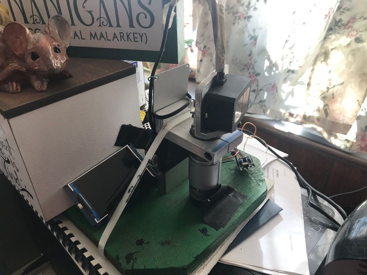
"add some tech from the drone world, you could have gps automation..map areas for it to clear, start, and moniter."
while I do have a job that GPS would seem to fit.
the job: --> when we get a few inches of snow I can no longer tell where sidewalks , lawn edges and driveways are.(covered with snow)
now all I can do is push until I spin my tires.(spinning tires draws 80amps)
using GPS to localize on a map of my area would be sweet.
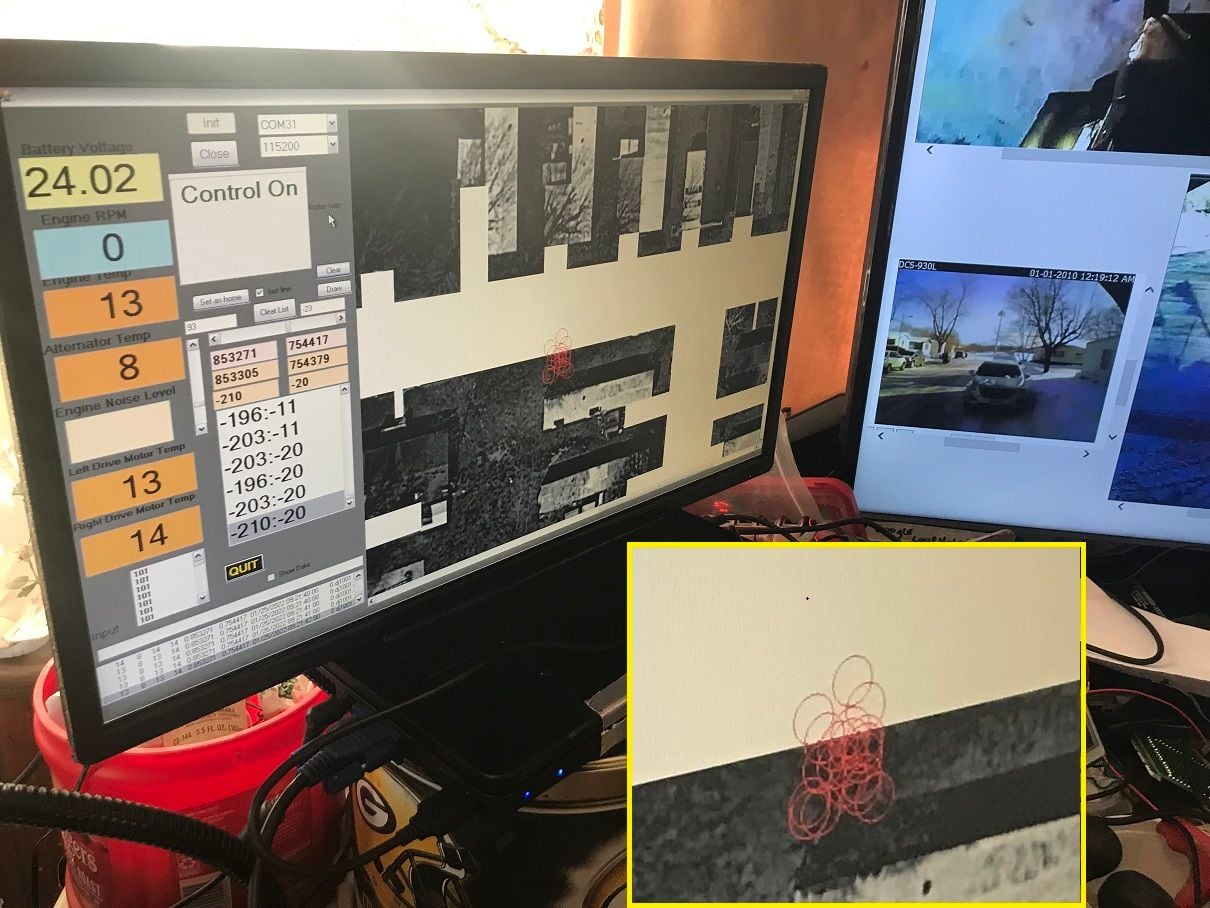
but it seems GPS can only do about 15ft accuracy.(crap!)
image above is after sitting in one spot for an hour.
because I have lots of straight lines in my area Lidar may be an option?